July 2021
Warning: Aboriginal and Torres Strait Islander readers should be aware that this posting contains images and names of people who may have since passed away.
John “Jack” Riverstone Faviell 1922-1933 photo album front cover
Discovered in an op shop (charity shop in America), this is the most historically important and exciting Australian photo album that I have ever found.
Belonging to John “Jack” Riverston Faviell, a senior New South Wales public accountant and featuring his photographs, the album ranges across the spectrum of Australian life and culture from the East to the West of the continent in the years 1922-1933. A list of locations and topics can be seen below.
I undertake a fuller analysis of the album in Part 2 of the posting in an essay titled Golden splendour: privilege, ceremony and racism in 1920s-1930s Australia (2023), the second part of the posting containing previously unpublished photographs of the opening of the Sydney Harbour Bridge.
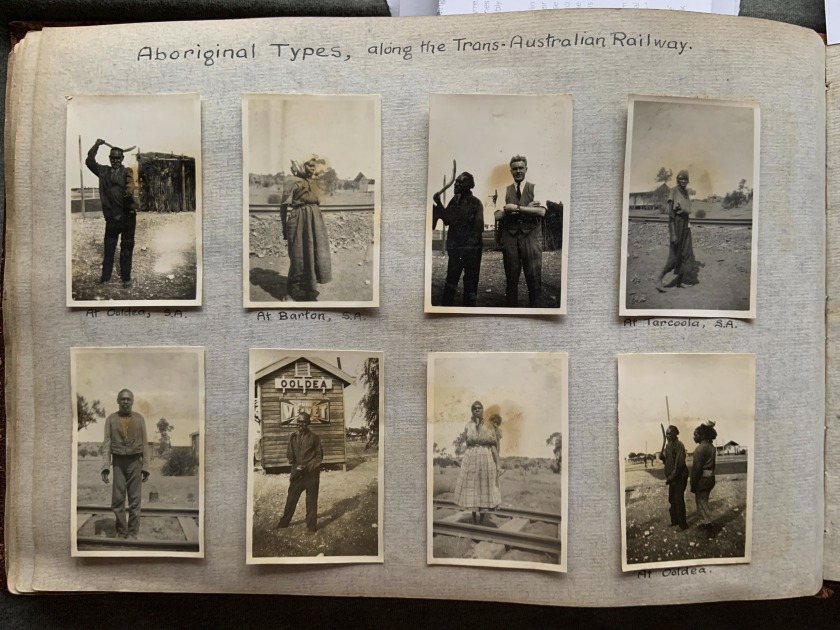
In this posting there are some important photographs of “Aboriginal Types, along the Trans-Australian Railway” and “Australian Desert Blacks.” The Indigenous Australians had come to trade boomerangs and spears in return for money and clothing. According to the excellent book Bitter Fruit: Australian photographs to 1963 by Michael Graham-Stewart and Francis McWhannell, after the completion of the continental railway in 1917,
“The Railway provided a source of income for Aboriginal people, much to the ire of the Chief Protector of Aborigines in Western Australia, A. O. Neville, to whom the slightest hint of autonomy was anathema. There was some begging (Neville was convinced that children were being ‘bred’ for the purpose), but also a system of charging for photographs. Boomerang and spear demonstrations were given, and artefacts were souvenired.
The most important stop on the line was Ooldea. This was situated six kilometres south of Ooldea Soak, one of the few places in the region with permanent water. The site had long been of great ceremonial and social significance for Aboriginal people, a fact attested by the profusion of stone artefacts in the area… It was a junction of migratory routes, a centre for exchange, and a refuge in times of drought.”1
As Episode 1 of the series ‘Australia in Colour’ states of similar home movie images, “these photographs offer an unfiltered glimpse into a world seldom seen.”2
Other fascinating images in this posting include the grave of bushranger John Dunn; the Macquarie Watchtower in La Perouse; the goldfields and mines of Kalgoorlie and “Boulder City” in Western Australia; the oldest inhabitant of Geraldton, W.A.; Fremantle prison; and pearling in Shark’s Bay, W.A. including two photographs – one of the dilapidated “White’s Cemetery” with single cross and bones and the other a “Grave in the Niggers Cemetery” with nothing but a mound of earth and some dead branches. Other photographs offer casual racism as a matter of course in their titles.
Dr Marcus Bunyan
PS. This album is now in the State Library of New South Wales collection, given its importance in documenting through photographs regional NSW, Indigenous Australians and the opening of the Sydney Harbour Bridge. See Part 2 of the posting for these previously unseen images of the opening of the bridge.
Footnotes
1/ Michael Graham-Stewart and Francis McWhannell. Bitter Fruit: Australian photographs to 1963. Michael Graham-Stewart, 2017, p. 66.
2/ Episode 1 Season 1: “Outpost Of Empire”: This episode charts the story of the nation from 1897 to 1929 as agriculture transforms the land. ‘Australia in Colour’ is the history of Australia told via a unique collection of cinematic moments brought to life for the first time in stunning colour. It tells the story of how Australia came to be the nation it is today. Narrated by Hugo Weaving, it’s a reflection on our nation’s character, its attitudes, its politics, and its struggle to value its Indigenous and multicultural past. ‘Australia in Colour’ gives us a chance to relive history from a fresh perspective.
Grateful thankx to Douglas Stewart Fine Books for their research help with this photo album. Please click on the photographs for a larger version of the image.
“Biscuits and cake and fruit were thrown to them from the train windows, while their boomerangs and native weapons, and their importance in the landscape as subjects for photography, brought many a shilling and sixpence for them to spend.”
Daisy Bates, The Passing of the Aborigines quoted in Bitter Fruit: Australian photographs to 1963.1
“John “Jack” Riverston Faviell, was a senior NSW public accountant. Originally from Colinroobie, near Narrandera in NSW, he married Melanie Audrey Pickburn (daughter of Judge Pickburn) in a society wedding at St James’ Church, Sydney, in February 1925. He built no. 20 Yarranabbe Rd, Darling Point as their first married home but he divorced Audrey in October 1930. He would later remarry in 1934, as would Audrey.”
Jon Dickson. Douglas Stewart Fine Books
Locations
Blue Mountains, NSW (1922)
Leura Falls, NSW (1922)
Weeping Rock, Wentworth Falls, NSW (1922)
Tarana Picnic Races, NSW (1922)
Doona, Breeza, NSW (1922)
Avoca, NSW (1922)
Newcastle Races, NSW (1923)
Belmont / Belmont Regatta, NSW (1923)
Hawkesbury, NSW (1923)
Frenches Forest, NSW (1923)
“Foxlow” Station, Bungedore, NSW (1923)
Sydney, NSW (Customs House, National Art Gallery, Mitchell Library, Darlinghurst Courthouse) (1923)
Muswellbrook Picnic Races, NSW (1923)
Maitland / Maitland Cup Meeting, NSW (1923)
Breeza, NSW (1923)
Wiseman’s Ferry, NSW (1923)
Moss Vale / Sutton Forest Church, NSW (1923)
Frensham, NSW (1923)
La Perouse, NSW (Historical Society Excursion) (1923)
Old Customs Watch Tower, La Perouse (1923)
The Old Illawarra Road, NSW (1923)
Yarcowie, SA (1923)
Trans-Australian Railway (Port Augusta to Kalgoorlie) (1923)
Karonie, WA (1923)
Kalgoorlie, WA (1923)
Boulder City, WA (1923)
Fremantle, WA (1923)
Geraldton, WA (1923)
Shark’s Bay, WA (1923)
Henry Freycinet Estuary, WA (1923)
Tamala Station, WA (1923)
Perth, WA (1923)
Adelaide, SA (Torrens River) (1923)
“Redbank,” Scone, NSW (1924)
Muswellbrook Picnic Races, NSW (1924)
“Craigieburn,” Bowral, NSW (1924)
The Dudley Cup at Kensington, NSW (1924)
Camden Grammar School, NSW (1924)
Liverpool Church, NSW (1924)
Landsdowne Bridge, NSW (1924)
Jenolan Caves, NSW (1924)
Avon Dam, NSW (1924)Herald Office, Pitt Street, NSW (1924)
Camping, Cronulla, NSW (1925)
Roseville, NSW (1926)
Whale Beach, NSW (1927)
Visit of the Duke and Duchess of York, Macquarie Street, NSW (1927)
20, Yarranabbe Rd., Darling Point, NSW (1926)
Canberra, ACT (1927)
Jenolan Caves, NSW (Lady Dorothy Hope-Morley) (1927)
Ellen’s Isle, Loch Katrine, Scotland (1925)
Sydney Harbour Bridge, NSW (1931-32)
“Springfield,” Byng, Near Orange, NSW (1932)
Lucknow, near Orange, NSW (1933)
Hawkesbury, NSW (1933)
Bathurst, NSW (1933)
“Millambri, ” Canowindra, NSW (1933)
Melbourne, VIC (1933)
Topics
Men
Pastoralism and grazing
Horses / country horse racing
Sheep and shearing
Cows
Mill / logging
Pine plantation
Bush
Bores and dams
Cathedral / churches
Tennis
Golf
Cars (Ford, Pan-American, Essex, Oldsmobile, early Hupmobile, Chrysler 70)
Buses
Bank, post office
Pastoral Play
Monuments
Rock carvings
Houses
Cemetery / tombstones
John Dunn, executed 1866
South Australian Railways / locomotives
S.A. constable and Adelaide cop
Indigenous Australians (Aboriginal types, along the Trans-Australian Railway)
Australian Desert Blacks
Gold mine / gold panning
Mining (Boulder and Perseverance Mines)
Convict gaol
Oldest inhabitant (Henry Desmond)
Hotels
Beach and sea, surf girls
Mother of pearl
Dates
Afghan / camels
Yachting, sailing / boats
Guano
Fred Adams, Boss-Pearler
Stations and station hands
Rowing
Dredging
Polo
Rugby
Caves
Guns
Nobility and royalty
Camping, picnics
Tennis
House building / old houses
Parliament House
Prime Ministers residence
Bridges and bridge building
Federal and state governors
The world’s first auto-gyro plane (1909-1912)
The Southern Cross
Pioneers
Mounted police
First house in Byng
Rabbiting
Glamour
Social status / socialite
Family
Women and children
Sydney Harbour Bridge opening
Carillon (bells)
Myers and Bourke Street, Melbourne
“Blue Mountains, N.S.W,” January, 1922 in John “Jack” Riverstone Faviell 1922-1933 photo album
“Blue Mountains, N.S.W,” January, 1922 in John “Jack” Riverstone Faviell 1922-1933 photo album
“Blue Mountains, N.S.W,” January, 1922 in John “Jack” Riverstone Faviell 1922-1933 photo album
Blue Mountains
The Blue Mountains are a mountainous region and a mountain range located in New South Wales, Australia. The region borders on Sydney’s metropolitan area, its foothills starting about 50 kilometres (31 mi) west of centre of the state capital, close to the major suburb of Penrith. The public’s understanding of the extent of the Blue Mountains is varied, as it forms only part of an extensive mountainous area associated with the Great Dividing Range. Officially the Blue Mountains region is bounded by the Nepean and Hawkesbury rivers in the east, the Coxs River and Lake Burragorang to the west and south, and the Wolgan and Colo rivers to the north. Geologically, it is situated in the central parts of the Sydney Basin. …
The Blue Mountains have been inhabited for millennia by the Gundungurra people, now represented by the Gundungurra Tribal Council Aboriginal Corporation based in Katoomba, and, in the lower Blue Mountains, by the Darug people, now represented by the Darug Tribal Aboriginal Corporation…
Examples of Aboriginal habitation can be found in many places. In the Red Hands Cave, a rock shelter near Glenbrook, the walls contain hand stencils from adults and children. On the southern side of Queen Elizabeth Drive, at Wentworth Falls, a rocky knoll has a large number of grinding grooves created by rubbing stone implements on the rock to shape and sharpen them. There are also carved images of animal tracks and an occupation cave. The site is known as Kings Tableland Aboriginal Site and dates back 22,000 years.
Text from the Wikipedia website
You’ll find the locality of Kanimbla Valley in New South Wales about 90km west-northwest of Sydney. At about 677m above sea level, Kanimbla Valley is one of the higher localities in New South Wales.
“Tarana Picnic Races,” January, 1922 in John “Jack” Riverstone Faviell 1922-1933 photo album
Tarana
Tarana is a small town in the Central West of New South Wales, Australia in the City of Lithgow.
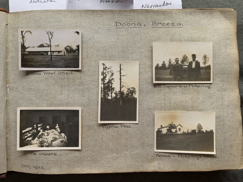
“Doona, Breeza,” October, 1922 in John “Jack” Riverstone Faviell 1922-1933 photo album
J. Pickering – John Pickering, grazier of Breeza, Upper Hunter Valley, killed by a log he was loading onto a wagon in February 1924.
B.B. Capper – Capper family of Rossmer Homestead at Breeza, Upper Hunter Valley.
Doona Station and Breeza Station owned by the Clift family.
Information from Douglas Stewart Fine Books
“Doona, Breeza,” October, 1922 in John “Jack” Riverstone Faviell 1922-1933 photo album
Breeza
Breeza is a small village located about 45 kilometres south east of Gunnedah on the Kamilaroi Highway. The aboriginal name for Breeza means “one hill”.
The village overlooks the rich fertile Liverpool Plains and this diverse farming area produces many and varied crops throughout the year. When in season, the fields of sunflowers, sorghum, canola, wheat and cotton provide a picturesque vista across the sweeping plains.
Breeza was settled in 1848 by Andrew Lang. Old folk say that Bushranger Ben Hall was born at Breeza, he was in fact born near Maitland, but his father, Ben Hall Snr worked on Breeza Station at one time. A mural ‘Ben Hall’s Wall’ stands in the heart of Breeza to commemorate Ben Hall’s final years set against “those wild colonial days” of yesteryear.
Text from the australias.guide website [Online] Cited 18/10/2019
“Avoca,” Xmas, 1922 in John “Jack” Riverstone Faviell 1922-1933 photo album
Avoca Beach
Avoca Beach is a coastal suburb of the Central Coast region of New South Wales, Australia, about 95 kilometres (59 mi) north of Sydney. Avoca Beach is primarily a residential suburb but also a popular tourist destination. Terrigal is a major coastal suburb of the Central Coast region of New South Wales, Australia, located 12 kilometres (7 mi) east of Gosford on the Pacific Ocean. (Text from the Wikipedia website)
“Newcastle Races,” New Year, 1923 in John “Jack” Riverstone Faviell 1922-1933 photo album
Located in the heart of Newcastle on the picturesque Hunter Coast only two hours drive north of Sydney is Newcastle Racecourse. In operation for over 100 years, the Newcastle Racecourse is the largest provincial club in NSW.
“Belmont,” New Year, 1923 in John “Jack” Riverstone Faviell 1922-1933 photo album
Belmont, on Lake Macquarie near Newcastle, NSW.
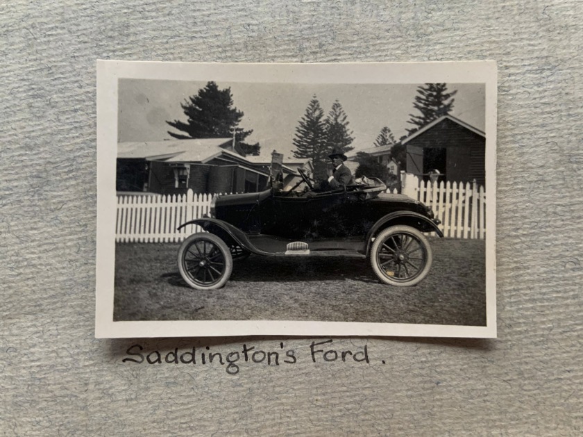
“Saddington’s Ford,” New Year, 1923 in John “Jack” Riverstone Faviell 1922-1933 photo album
“Belmont,” 1923 in John “Jack” Riverstone Faviell 1922-1933 photo album
John C Reid and Mark C Reid
The Reid brothers John C Reid and Mark C Reid were nephews of Sir George Houstoun Reid, 4th Prime Minister of Australia and former Premier of New South Wales prior to Federation. On Friday 14 January, 1898 the Reid boys were at the train station to welcome their uncle the Premier to Newcastle.
Roger Steel, Historian, Belmont
O.E. Friend (died 1942)
O.E. Friend was a very wealthy man and was Director of the Commercial Banking Company of Sydney with a keen interest in pastoral pursuits, investments, etc., Perhaps Faviell worked for Friend or was a close confidante, which would explain all the shots of pastoral locations (Friend’s interests).
Information from Douglas Stewart Fine Books
Obituary
MR. O. E. FRIEND DIES IN SYDNEY
Mr O. E. Friend, 60, died today. He was a director of the Permanent Trustee Company, the Commercial Banking Company of Sydney, Pitt, Son, and Badgery, the United Insurance, and Howard Smith companies, and several other business organisations. Mr. Friend was keenly interested in pastoral pursuits. He was chairman of directors of Retreat Station Ltd., Queensland, and was formerly president of the Royal Historical Society.
The Courier-Mail, Brisbane, Qld., Tue 26 May, 1942, Page 4 on the Trove website [Online] Cited 05/11/2019
“Belmont Regatta,” 1.1.23 in John “Jack” Riverstone Faviell 1922-1933 photo album
Belmont Regatta
I am researching the local history of Belmont, NSW and in particular the history of the Belmont Sailing Club. The Belmont Sailing Club was formed at a meeting on 13th May 1922 and it held its first race on 7th October 1922.
Whilst an annual regatta had been held on Belmont Bay for some decades, the Belmont Regatta held on 1st January 1923 is the first run under the auspices of the newly formed Belmont Sailing Club. The photo in the album would be the earliest photograph of 16ft skiffs sailing on Belmont Bay.
Interestingly, John C. Reid, living in Weeroona on the shores of Lake Macquarie was the sailing club’s first patron, having been involved previously with the Belmont regattas as well as the regattas held on Newcastle Harbour. He was also a benefactor providing trophies for the club and had a high profile having formerly been the Mayor of Newcastle and the French Consul for Newcastle, there to assist French sailors. He played a significant role following the wreck of the ship Adolphe (1904, see below) in Newcastle Harbour. His younger brother Mark Christian Reid was the sailing club’s first President. Both of these men lived truly amazing lives.
Is there any possibility of getting a high resolution scan of a few of these photographs? In particular the photo of the 1923 Belmont Regatta is priceless.
The skiffs in the club then used numbers on their sails instead of ensigns like other 16ft skiff clubs. Its hard to see, but it looks like the leading skiff has the number one on the sail, making it the skiff named ‘Clift’ (No numbers are visible on the sails just splotches – Marcus). That name Clift is significant in Belmont as you can see from your photo album. The Clifts were wealthy graziers from Breeza who would holiday at Belmont in their 17 room home.
Roger Steel, Historian, Belmont
Email to Marcus Bunyan 07/07/2021
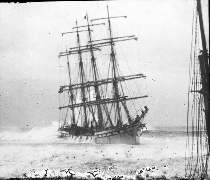
This slide depicts the wreck of the Adolphe as photographed on 30 September 1904. You can also see the mast of the shipwreck Regent Murray in this photo.
University of Newcastle Library’s Cultural Collections
Adolphe
The Adolphe was a sailing ship that was wrecked at the mouth of the Hunter River in New South Wales, Australia, in 1904. The ship is now the most prominent of several wrecks on what is now the Stockton breakwall, which protects Newcastle harbour. The rescue of the ship’s crew has gone down in local maritime history as one of the most remarkable in local waters.
On 30 September 1904, the Adolphe was being towed through the entrance of Newcastle harbour by the tugs Hero and Victoria after an 85-day voyage in ballast from Antwerp under the command of Captain Lucas. Heavy seas prevented the tugs from holding her, and after the tug hawser parted she was swept first on to the wreck of the Colonist, then battered by waves that forced her on top of other submerged wrecks on what was then called the Oyster Bank. The lifeboat hurried to the scene and within two hours all 32 of the crew had been taken off. The northern breakwater of the entrance to the port of Newcastle was extended after the loss of the Adolphe. The French consul made an official visit to Newcastle to recognise the efforts of the lifeboat crew.
Text from the Wikipedia website
“Fun at The Lake,” 17/19 February, 1923 in John “Jack” Riverstone Faviell 1922-1933 photo album
“O.E.F. (O.E. Friend) & B.B.C. (Basil Cappers),” 17/19 February, 1923 in John “Jack” Riverstone Faviell 1922-1933 photo album
“The Basil Cappers’ departure for England,” 9 March, 1923 in John “Jack” Riverstone Faviell 1922-1933 photo album
“Untitled,” 1923 in John “Jack” Riverstone Faviell 1922-1933 photo album
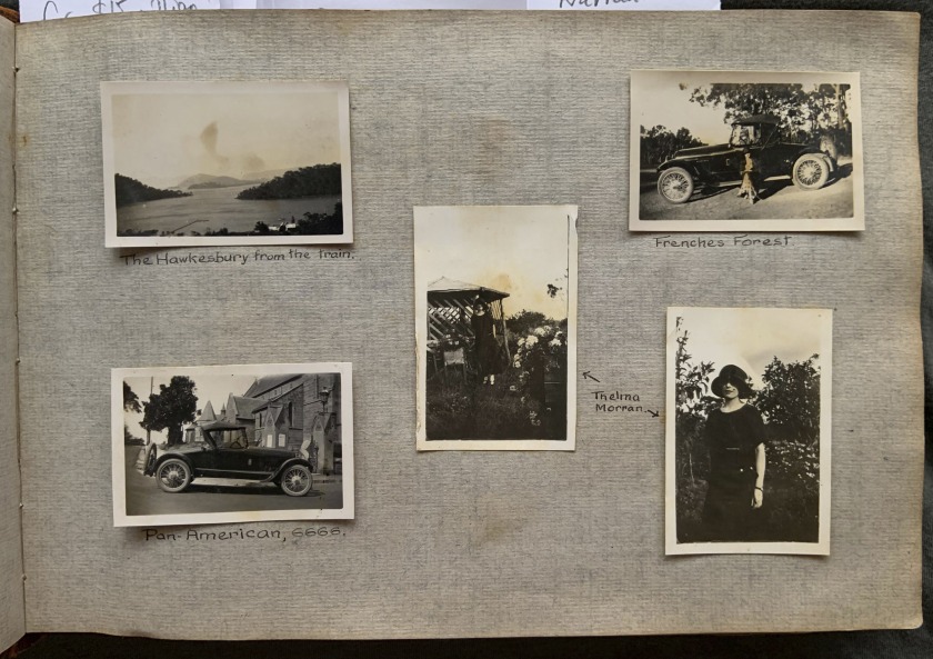
“Pan-American, 6666,” 1923 in John “Jack” Riverstone Faviell 1922-1933 photo album
“The Hawkesbury from the train,” 1923 in John “Jack” Riverstone Faviell 1922-1933 photo album
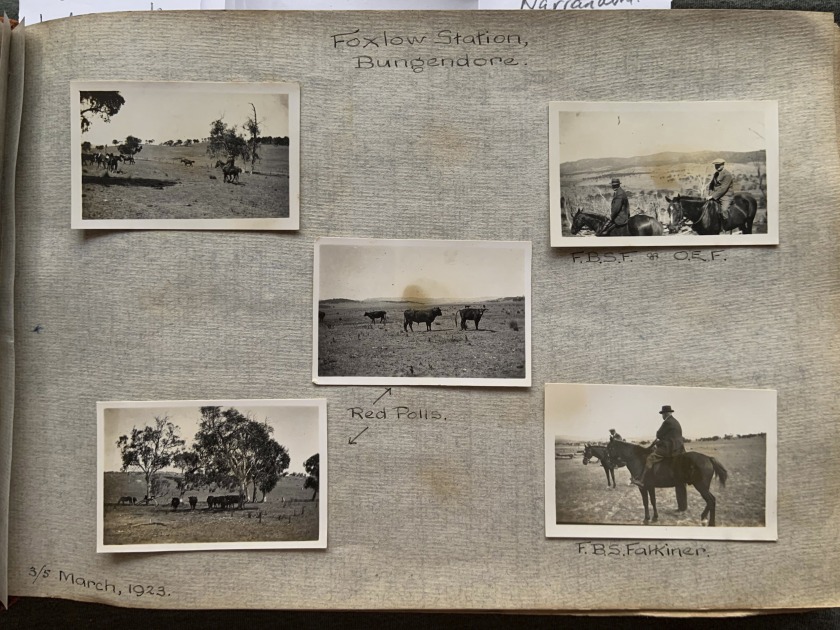
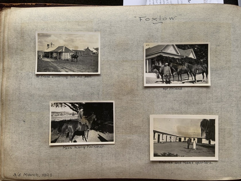
“Foxlow,” 3/5 March, 1923 in John “Jack” Riverstone Faviell 1922-1933 photo album
“Foxlow,” March, 1923 in John “Jack” Riverstone Faviell 1922-1933 photo album
“Foxlow,” 3/5 March, 1923 in John “Jack” Riverstone Faviell 1922-1933 photo album
“Foxlow Station, Bungendore,” 3/5 March, 1923 in John “Jack” Riverstone Faviell 1922-1933 photo album
“Foxlow,” 3/5 March, 1923 in John “Jack” Riverstone Faviell 1922-1933 photo album
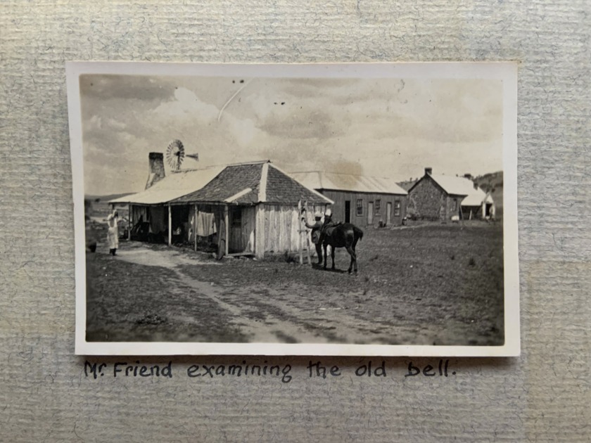
Foxlow
Bungendore property “Foxlow” has more than 7500 hectares of land. It was purchased by F.B.S Falkiner (the son of F.S. Falkiner) in 1920.
Before the Falkiner family ownership, “Foxlow” had been in the hands of the Osborne family, and previously the Rutledge family; they had a short ownership of two years after purchasing it from John Hosking, in the 1860s. Hosking himself was the first mayor of Sydney, and had given the property its name, after his wife, Martha Foxlow Terry.
Mr Falkiner said “Foxlow” was one of the first farms to be taken up in the Molonglo Valley.
The property was profiled in The Land‘s country homes series in 1976, which detailed the property’s history extending back to an original grant in 1839 to Thomas Wood.
It is not known exactly when Hosking himself purchased the property, but his ownership lasted until 1868 when it was purchased by Thomas Rutledge, and then later George Osborne, who had owned the property for 50 years before the Falkiner family ownership.
Nick Heydon. “Historic ‘Foxlow’ offering,” on The Land website 26 April 2014 [Online] Cited 28/10/2019
Foxlow sold for $15 million in 2015.
“Mr Friend examining the old bell,” March, 1923 in John “Jack” Riverstone Faviell 1922-1933 photo album
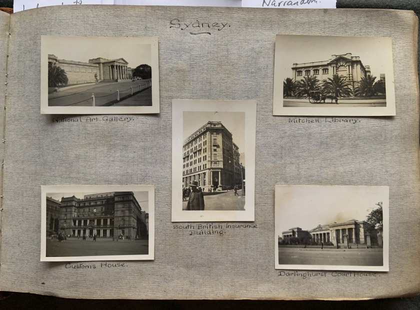
“Sydney,” 1923 in John “Jack” Riverstone Faviell 1922-1933 photo album
“Customs House,” Sydney, 1923 in John “Jack” Riverstone Faviell 1922-1933 photo album
Customs House, Sydney
Customs House, Sydney is a heritage-listed museum space, visitor attraction, commercial building and performance space located in the Circular Quay area at 45 Alfred Street, in the Sydney central business district, in the City of Sydney local government area of New South Wales, Australia. The building served as a customs house prior to Federation and then as the head office of New South Wales operations of the Government of Australia agency Department of Trade and Customs (and its successors) until 1988. The customs function relocated to a new site in 1990. The initial designs were by Mortimer Lewis and it was built during 1845 by under the administration of Governor Sir George Gipps.
Text from the Wikipedia website
“National Art Gallery,” Sydney, 1923 in John “Jack” Riverstone Faviell 1922-1933 photo album
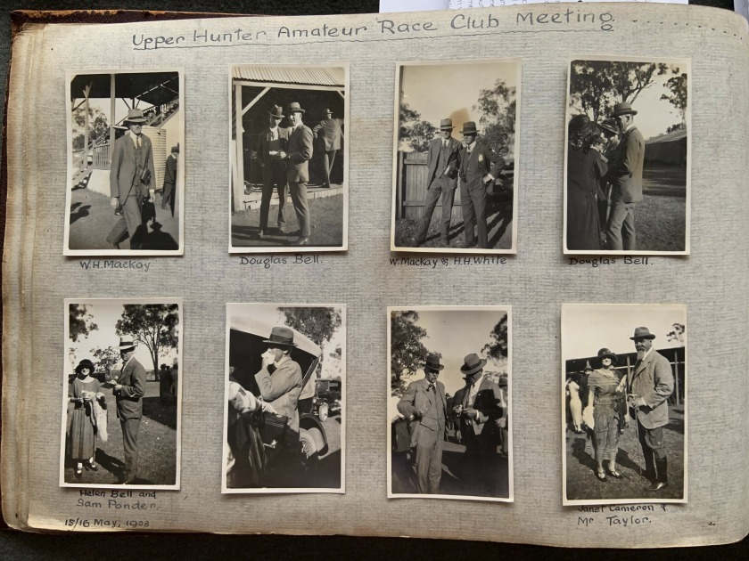
“Upper Hunter Amateur Race Club Meeting… (Muswellbrook Picnic Races)” 15/16 May, 1923 in John “Jack” Riverstone Faviell 1922-1933 photo album
Muswellbrook
Muswellbrook is a town in the Upper Hunter Region of New South Wales, Australia, about 243 km (151 mi) north of Sydney and 127 km (79 mi) north-west of Newcastle. Geologically, Muswellbrook is situated in the northern parts of the Sydney basin, bordering the New England region. The area is predominantly known for coal mining and horse breeding, but has also developed a reputation for gourmet food and wine production.
Text from the Wikipedia website
“Upper Hunter Amateur Race Club Meeting… (Muswellbrook Picnic Races)” 15/16 May, 1923 in John “Jack” Riverstone Faviell 1922-1933 photo album
“The Button’s Essex,” May, 1923 in John “Jack” Riverstone Faviell 1922-1933 photo album
“Muswellbrook Picnic Races,” 15/16 May, 1923 in John “Jack” Riverstone Faviell 1922-1933 photo album
“Muswellbrook Picnic Races,” 15/16 May, 1923 in John “Jack” Riverstone Faviell 1922-1933 photo album
“Belmont,” 23/25 June, 1923 in John “Jack” Riverstone Faviell 1922-1933 photo album
Three women standing in front of Belmont Soldier’s Memorial Hall (middle) and Belmont School of Arts (right) in John “Jack” Riverstone Faviell 1922-1933 photo album
Belmont Soldier’s Memorial Hall and Belmont School of Arts
My interest in the photo of the women in front of the Belmont Soldier’s Memorial Hall (opened 1921) (above) is also in the hope of seeing what is written on the building beside it (it says Belmont Literary Institute – more commonly known as the Belmont School of Arts, opened 1914). If it is the School of Arts, this suggests the building may have been moved at some stage. I’m very curious as I believed the School of Arts was close by in an adjoining street.
Roger Steel, Historian, Belmont
Belmont
Belmont is a suburb in the Hunter Region of New South Wales, Australia, located 20 kilometres (12 mi) from Newcastle’s central business district on the eastern side of Lake Macquarie and is part of the City of Lake Macquarie. Belmont is situated on a sandy peninsula formed by the Tasman Sea on the east and Lake Macquarie.
“”Weroona”, Belmont,” 23/25 June, 1923 in John “Jack” Riverstone Faviell 1922-1933 photo album
3 women at Weeroona in John “Jack” Riverstone Faviell 1922-1933 photo album
Weeroona and the Reid’s
If we look carefully at the photograph of the 3 women at Weeroona with the lake in the back ground (above), you can see the old stone ferry jetty. It was in a state of disrepair in 1923 and Mark C Reid, having been a former Alderman on Newcastle Council and a very prominent business man, was lobbying Lake Macquarie Shire Council to have the jetty repaired. Note this jetty became the club house of Lake Macquarie Yacht Club in the early 1930’s, built at the end of the pier, and still in the same location to this day. I’ve attached an old postcard (below) which shows a view of the yacht club from the Weeroona boatshed.
Some of the information from the Wikipedia page is not correct (below). John C Reid didn’t live in Weeroona during his retirement as he died relatively young and Mark C Reid took over his brother’s position as manager of John Reid Limited and as French Consul following his brother’s unexpected death. The Crippled Children’s Association did purchase Weeroona in about 1950 following Mark C Reid’s death however based on my memory, Weeroona would have been demolished much later than 1979.
Roger Steel, Historian, Belmont
John Christian Reid
John Christian Reid, JP (1873 – 20 March 1932) was a New South Wales businessman, yachtsman and alderman, who served several terms as Mayor of Newcastle… In retirement, Reid lived with his family at his residence, “Weroona”, in Belmont, which later became the holiday home for the NSW Crippled Children’s Association and was demolished in 1979.
Text from the Wikipedia website
The Reid’s water-front, Lake Macquarie in John “Jack” Riverstone Faviell 1922-1933 photo album
Belmont, Near Newcastle
1950s?
Postcard
Colour lithograph
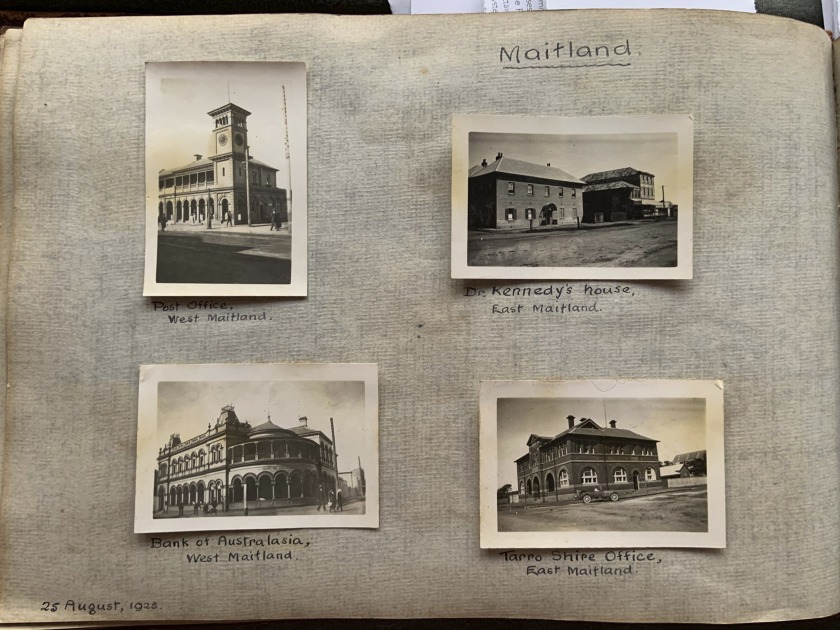
“Maitland,” 25 August, 1923 in John “Jack” Riverstone Faviell 1922-1933 photo album
Maitland
Maitland is a city in the Lower Hunter Valley of New South Wales, Australia and the seat of Maitland City Council, situated on the Hunter River approximately 166 kilometres (103 mi) by road north of Sydney and 35 km (22 mi) north-west of Newcastle. It is on the New England Highway about 17 km (11 mi) from its start at Hexham.
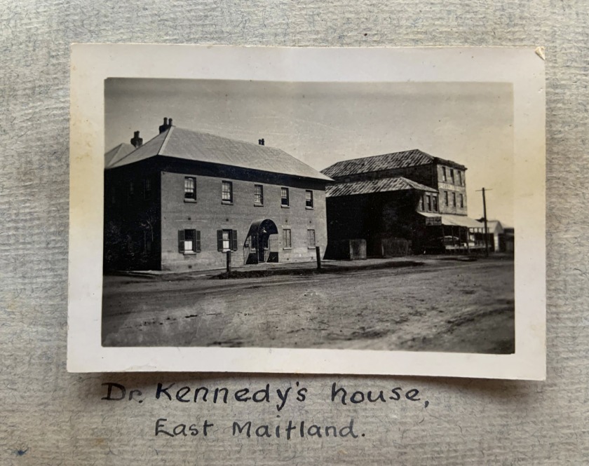
“Dr Kennedy’s house, East Maitland,” August, 1923 in John “Jack” Riverstone Faviell 1922-1933 photo album
“Maitland Cup Meeting,” Spring, 1923 in John “Jack” Riverstone Faviell 1922-1933 photo album
“Finish of The Cup,” Spring, 1923 in John “Jack” Riverstone Faviell 1922-1933 photo album
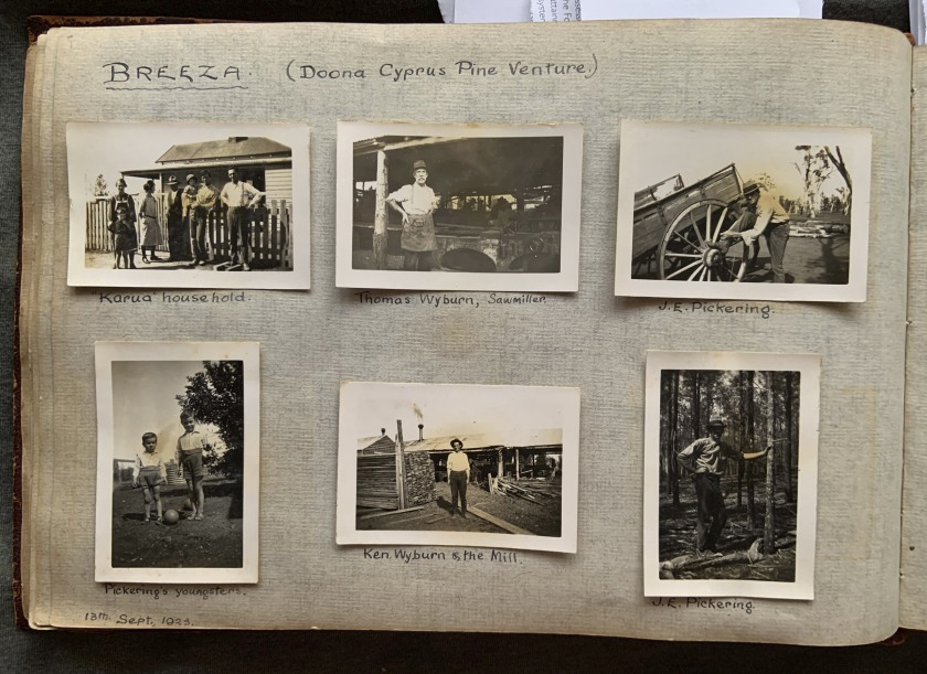
“Breeza (Doona Cyprus Pine Venture),” 13th September, 1923 in John “Jack” Riverstone Faviell 1922-1933 photo album
“”Karua” household,” September, 1923 in John “Jack” Riverstone Faviell 1922-1933 photo album
“Breeza,” 13th September, 1923 in John “Jack” Riverstone Faviell 1922-1933 photo album
John Pickering was killed by a log, 1924. Cyprus Pine venture was an investment project that Friend and Faviell were working on with Pickering and Capper?
Information from Douglas Stewart Fine Books
Breeza
Breeza is a locality in New South Wales, Australia. It is about 43 kilometres south of Gunnedah, in the Liverpool Plains agricultural region. The area around Breeza in particular is called the “Breeza Plains”. The name “Breeza” may be derived from an Aboriginal word meaning “one hill”.
“The team in the bush,” Breeza, September 1923 in John “Jack” Riverstone Faviell 1922-1933 photo album
“Breeza,” 13th September, 1923 in John “Jack” Riverstone Faviell 1922-1933 photo album
“Wiseman’s Ferry,” 25 November, 1923 in John “Jack” Riverstone Faviell 1922-1933 photo album
Wisemans Ferry
Wisemans Ferry is a town in the state of New South Wales, Australia, located 75 kilometres north north-west of the Sydney central business district in the local government areas of Hornsby Shire, The Hills Shire, City of Hawkesbury and Central Coast Council. The town is a tourist spot with picnic and barbecue facilities. As well as a rich convict and colonial heritage in the area, the Dharug National Park and Yengo National Park are close by.
The town was originally called Lower Portland Headland, but the name was eventually changed to Wisemans Ferry, named after Solomon Wiseman, a former convict (1778-1838), who received a land grant in the area from Governor Macquarie in 1817. Wiseman established a ferry service on the Hawkesbury River in 1827 for the transport of produce and provisions to the convicts building the Great North Road and was known to many as King of the Hawkesbury.
Text from the Wikipedia website
“Moss Vale,” 8/9 December, 1923 in John “Jack” Riverstone Faviell 1922-1933 photo album
Moss Vale
Moss Vale is a town in the Southern Highlands of New South Wales, Australia, in the Wingecarribee Shire. At the 2016 census, it has a population of 8,579 and is sited on the Illawarra Highway, which connects to Wollongong and the Illawarra coast via Macquarie Pass.
“Frensham Pastoral Play,” 8th December 1923 in John “Jack” Riverstone Faviell 1922-1933 photo album
Frensham School
Frensham School is an independent non-denominational comprehensive single-sex early learning, primary, and secondary day and boarding school for girls, located at Mittagong, south of Sydney, in the Southern Highlands region of New South Wales, Australia.
“La Perouse (Historical Society Excursion),” 17 November, 1923 in John “Jack” Riverstone Faviell 1922-1933 photo album
Captain J. H. Watson, Royal Historical Society
O.E. Friend was President of the Royal Historical Society. Faviell was evidently also a member and visited La Perouse on a RHS excursion, with O.E. Friend. Friend disappears from the album after this time. Did Friend and Faviell part ways?
Information from Douglas Stewart Fine Books
La Perouse
La Perouse is a suburb in south-eastern Sydney, in the state of New South Wales, Australia. The suburb of La Perouse is located about 14 kilometres southeast of the Sydney central business district, in the City of Randwick.
“La Perouse (Historical Society Excursion),” 17 November, 1923 in John “Jack” Riverstone Faviell 1922-1933 photo album
“John Dunn. Executed, 19.3.1866,” 17 November, 1923 in John “Jack” Riverstone Faviell 1922-1933 photo album
John Dunn
John Dunn (14 December 1846 – 19 March 1866) was an Australian bushranger. He was born at Murrumburrah near Yass in New South Wales. He was 19 years old when he was hanged in Darlinghurst Gaol. He was buried in the former Devonshire Street Cemetery in Sydney.
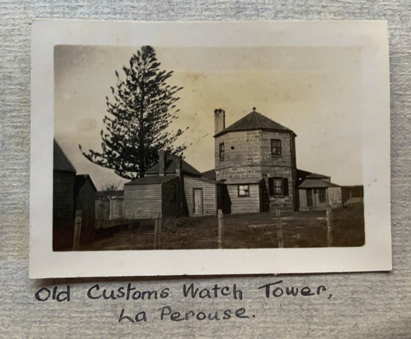
“Old Customs Watch Tower, La Perouse,” 17 November, 1923 in John “Jack” Riverstone Faviell 1922-1933 photo album
Macquarie Watchtower
The Macquarie Watchtower is the earliest known surviving, sandstone tower building in Australia, the oldest surviving building on Botany Bay, and has long been recognised as a picturesque landmark on the headland, particularly popular for wedding photographs. The c. 1820 Macquarie Watchtower is thought to have been commissioned by Governor Macquarie. Not only is it the oldest surviving watchtower in Australia but it is the only known tower specifically constructed for colonial border protection and the prevention of smuggling.
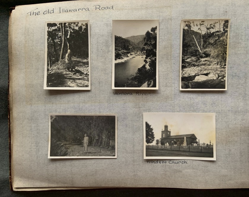
“The old Illawarra Road,” 1923 in John “Jack” Riverstone Faviell 1922-1933 photo album
“Vera Capper and the children,” 1923 in John “Jack” Riverstone Faviell 1922-1933 photo album
“South Australian Railways,” 1923 in John “Jack” Riverstone Faviell 1922-1933 photo album
South Australian Railways
South Australian Railways (SAR) was the statutory corporation through which the Government of South Australia built and operated railways in South Australia from 1854 until March 1978, when its non-urban railways were incorporated into Australian National, and its Adelaide urban lines were transferred to the State Transport Authority.
“Terowie to Pt. Augusta, 120 ml.,” 1923 in John “Jack” Riverstone Faviell 1922-1933 photo album
“S.A. Constable,” 1923 in John “Jack” Riverstone Faviell 1922-1933 photo album
“Trans-Australian Railway (Port August to Kalgoorlie, 1051 miles),” 1923 in John “Jack” Riverstone Faviell 1922-1933 photo album
Trans-Australian Railway
The Trans-Australian Railway crosses the Nullarbor Plain of Australia from Port Augusta in South Australia to Kalgoorlie in Western Australia. It includes a 478-kilometre (297 mi) stretch of dead-straight track, the world’s longest, between the 797 km (495 mi) post west of Ooldea and the 1,275 km (792 mi) post west of Loongana.
The line forms an important freight route between Western Australia and the eastern states. Currently two passenger services also use the line, the Indian Pacific for its entire length and The Ghan between Port Augusta and Tarcoola. Earlier passenger services on the route were known as the Great Western Express.
Text from the Wikipedia website
“Aboriginal Types, along the Trans-Australian Railway,” 1923 in John “Jack” Riverstone Faviell 1922-1933 photo album
“At Ooldea, S.A.,” 1923 in John “Jack” Riverstone Faviell 1922-1933 photo album
“At Barton, S.A.,” 1923 in John “Jack” Riverstone Faviell 1922-1933 photo album
“Ooldea,” 1923 in John “Jack” Riverstone Faviell 1922-1933 photo album
Ooldea
Ooldea is a tiny settlement in South Australia. It is on the eastern edge of the Nullarbor Plain, 863 km (536 mi) west of Port Augusta on the Trans-Australian Railway. Ooldea is 143 km (89 mi) from the bitumen Eyre Highway.
“At Ooldea,” 1923 in John “Jack” Riverstone Faviell 1922-1933 photo album
“Australian Desert Blacks,” 1923 in John “Jack” Riverstone Faviell 1922-1933 photo album
“Untitled,” 1923 in John “Jack” Riverstone Faviell 1922-1933 photo album
“Kalgoorlie,” 1923 in John “Jack” Riverstone Faviell 1922-1933 photo album
Kalgoorlie-Boulder
Kalgoorlie-Boulder, known colloquially as just Kalgoorlie, is a city in the Goldfields-Esperance region of Western Australia, located 595 km (370 mi) east-northeast of Perth at the end of the Great Eastern Highway. The city was founded in 1889 by the amalgamation of the towns of Kalgoorlie and Boulder, which developed in 1893 during the Coolgardie gold rush, on Western Australia’s “Golden Mile”. It is also the ultimate destination of the Goldfields Water Supply Scheme and the Golden Pipeline Heritage Trail.
Text from the Wikipedia website
“Where gold was first found, by Hannan. 15 Jan., 1893,” 1923 in John “Jack” Riverstone Faviell 1922-1933 photo album
“Boulder City,” 1923 in John “Jack” Riverstone Faviell 1922-1933 photo album
Boulder
Boulder is a suburb in the Western Australian Goldfields 595 kilometres (370 mi) east of Perth and bordering onto the town of Kalgoorlie in the Eastern Goldfields region.
“Perseverence Mine,” 1923 in John “Jack” Riverstone Faviell 1922-1933 photo album
Perseverance Gold Mine, Golden Mile Mines, Kalgoorlie-Boulder, Kalgoorlie-Boulder Shire, Western Australia, Australia
The lease was spoken as the richest 24 acre block on the Golden Mile in 1901. Ten shafts were on the lease, but the two most important was Main Shaft (700feet 1901) in the centre of the block accessing the Perseverance Lode, and No6 Shaft (600 feet 1901) near the southern boundary on the Consols Lode. Measurements are in imperial in keeping with the historic references. Lake View Consols was to its north, South Kalgurli to its south, Associated to its east, and Great Boulder Proprietary to its west.
The general manager of the mine was Ralph Nicholls who arrived in July 1899, about three years after the mine opened. He was in for a torrid time later. A new mill was constructed shortly after to process the sulphide ore, while remaining oxidised ore was taken to Hannan’s Public Crushing Company, which the mine owned. All ore was processed at a new mill constructed on the lease in 1910.
Around 1900 a series of scandals hit the Golden Mile mines. From 1896-1900 they had mined incredibly rich ore loads, but as these became exhausted, lower (but still very profitable) gold grades became the norm. Several of the mines had over estimated the potential gold which could be extracted, leading to wild fluctuations in share prices. Employees of the companies were accused of what we would now call insider trading of shares they owned.
Around 1903, the Boulder Perseverance Mine was the latest to be caught in the scandal. The outcry finally forced the Government’s hand which launched a Royal Commission. Delivering its report in 1904, it was scathing of the company.
Text from “Perseverance Gold Mine (Boulder Perseverance Mine),” on the mindat.org website [Online] Cited 29/10/2019
“Boulder Mine,” 1923 in John “Jack” Riverstone Faviell 1922-1933 photo album
Great Boulder Gold Mine, Golden Mile Mines, Kalgoorlie-Boulder, Kalgoorlie-Boulder Shire, Western Australia, Australia
The Great Boulder Mine was the first large scale mine on the Golden Mile, and considered the largest and richest on the field.
The town of Boulder (as in Kalgoorlie-Boulder) was named after the mine.
Visitors to the underground workings in the early part of the Twentieth Century wrote in amazement at seeing ore shoots loaded with fine grained gold. One writer wrote the battery was barely keeping up with gold being processed from the access tunnels, let alone the ore shoots. In 1929 the mine had extracted the most gold of any location in Western Australia. In 1940 it was noted as the second largest producer to that point in Australia.
The discovery of gold at Hannans, just north of the Golden Mile, led to the greatest gold-rush in Australia’s history. After only a couple of years of frenzied activity, by thousands of individual miners, the alluvial gold had been exhausted.
British speculators successfully floated the Great Boulder and Lakeview Mines in 1895 to access the rich underground reefs. The Great Boulder Gold Mines Limited was formed at this time, until it ceased as a company in 1972. …
Between 1895-1931 over four million tonnes of ore was processed for almost the same amount in ounces of gold. Dividends amounted to 3524% of the initial capital invested. The company had produced 15 million pounds of gold monetary wise, and 7.5 million pounds in profits.
Text from “Great Boulder Gold Mine,” on the mindat.org website [Online] Cited 29/10/2019
“Fremantle,” 1923 in John “Jack” Riverstone Faviell 1922-1933 photo album
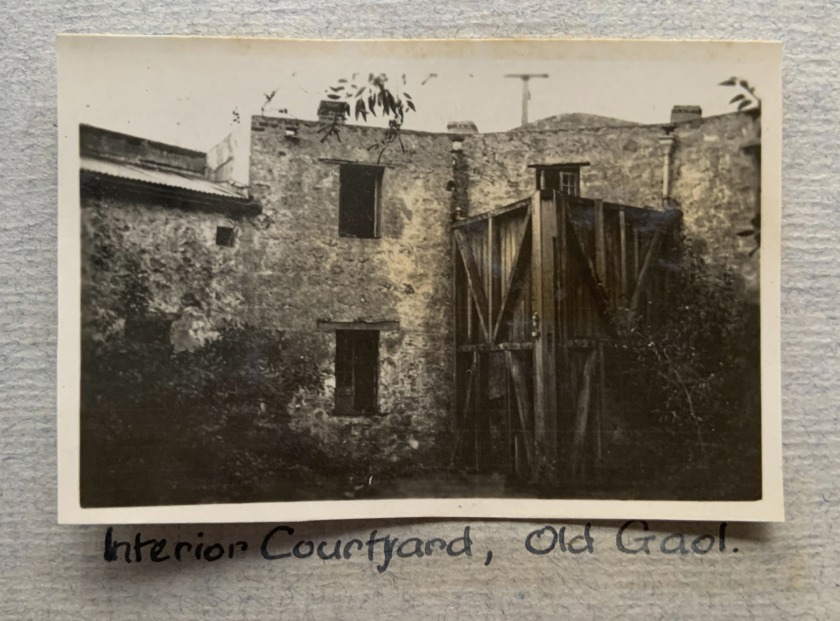
“Interior Courtyard, Old Gaol,” Fremantle, 1923 in John “Jack” Riverstone Faviell 1922-1933 photo album
Fremantle Prison
Fremantle Prison, sometimes referred to as Fremantle Gaol or Fremantle Jail, is a former Australian prison and World Heritage Site in Fremantle, Western Australia. The six-hectare (15-acre) site includes the prison cellblocks, gatehouse, perimeter walls, cottages, and tunnels. It was initially used for convicts transported from Britain, but was transferred to the colonial government in 1886 for use for locally-sentenced prisoners. Royal Commissions were held in 1898 and 1911, and instigated some reform to the prison system, but significant changes did not begin until the 1960s.
Text from the Wikipedia website
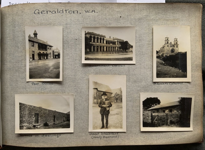
“Geraldton, W.A.,” in John “Jack” Riverstone Faviell 1922-1933 photo album
Geraldton
Geraldton is a coastal city in the Mid West region of the Australian state of Western Australia, 424 kilometres (263 mi) north of the state capital, Perth.
“Oldest Inhabitant (Henry Desmond.),” Geraldton, W.A. 1923 in John “Jack” Riverstone Faviell 1922-1933 photo album
“Shark’s Bay, W.A.,” 1923 in John “Jack” Riverstone Faviell 1922-1933 photo album
Pearling interests? Investments? in Western Australia (Information from Douglas Stewart Fine Books)
Shark Bay
Shark Bay is a World Heritage Site in the Gascoyne region of Western Australia. The 23,000-square-kilometre (8,900 sq mi) area is located approximately 800 kilometres (500 mi) north of Perth, on the westernmost point of the Australian continent.
“The only street (Entirely paved of Mother of Pearl),” 1923 in John “Jack” Riverstone Faviell 1922-1933 photo album
“Shark’s Bay,” 1923 in John “Jack” Riverstone Faviell 1922-1933 photo album
“White’s Cemetery,” Shark’s Bay, 1923 in John “Jack” Riverstone Faviell 1922-1933 photo album
“Grave in Nigger’s Cemetery,” Shark’s Bay, 1923 in John “Jack” Riverstone Faviell 1922-1933 photo album
“Shark’s Bay,” 1923 in John “Jack” Riverstone Faviell 1922-1933 photo album
Gin
Gin is the term for an Aboriginal woman. It is racist, the derogatory saying most people would be familiar with is “looks like a gin’s camp”, meaning they think the place is dirty/untidy.
“Shark’s Bay,” 1923 in John “Jack” Riverstone Faviell 1922-1933 photo album
“All Mother-of-Pearl,” 1923 in John “Jack” Riverstone Faviell 1922-1933 photo album
























You must be logged in to post a comment.